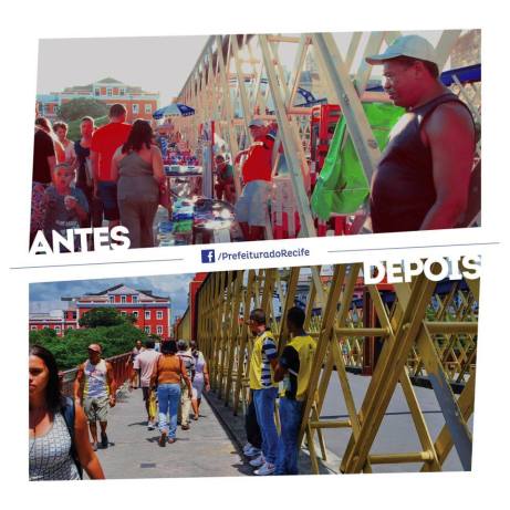
“The Boa Vista Bridge, that connects Rua Nova, in the Santo Antônio neighborhood, to the Rua da Imperatriz, in Boa Vista, has been returned to the pedestrians. Since yesterday morning, the street vendors that for decades have occupied the walkways, were relocated to Avenida Dantas Barreto by the Secretary of Mobility and Urban Control (Semoc). Today, city maintenance crews from Emlurb will also paint the bridge.
The transfer of the informal vendors is the result of meetings with their representatives. Up until now, 13 areas of the downtown area have followed suit (Duque de Caxias, Estreita do Rosário, Rua Josefa Paes Carvalho, Nova, Imperatriz, Flores, Frei Caneca, João Souto Maior, Largo do Carmo, Praça do Carmo, Praça do Livramento, Praça do Sebo and the continuation of Rua Sete de Setembro, in the direction of the José Mariano Pier).
As of yesterday, inspectors from the Recife Urban Services Company (Csurb), an entity connected to Semoc, have already intensified the supervision of the area, with the aim of making sure the usual vendors don’t return and that new ones don’t set up shop there. The operation took place on the 30th of September, but attending to the request of the vendors, who wanted to take advantage of the sales period of Children’s Day, the timeline was increased until the 13th of October.
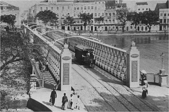
History — With an entirely metalic structure, made in England, all of it with wrought iron and thus why it’s known as the Iron Bridge (Ponte de Ferro), the Boa Vista Bridge was built in the era of the Dutch occupation, in 1640. It went through various interventions, and was eventurally demolished and rebuilt. The bridge has four columns at the entrances, where there are engraved inscriptions that have recorded dates and historic facts relevant to Pernambuco and Brazil, like the Dutch invasion, the Tabocas and Guararapes Battles, the restauration of Pernambuco, the 1817 Revolution, and the Ecuador Confederation, among others.
The structure’s last large intervention occurred in 1967, after having been partially destroyed in 1965 and 1966 by the flooding of the Capibaribe river. At the time, the Institute of National Historic and Artistic Heritage (Iphan) embargoed the operation, but its walkways had already been expanded, its pillars united by a concrete coating up to the water level and the entire structure’s lower section made with material used for stabilization had been laid.” – Source (PT)
(Another short video report on the changes, in PT)
_____
If you’re interested in Recife bridges, see my article on the Story of the Flying Ox. To read about the flooding of Recife (though not the one in the article above) in 1975, check out When Recife Went Underwater.


